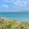
North Wales Downwind Hydrofoil Guide
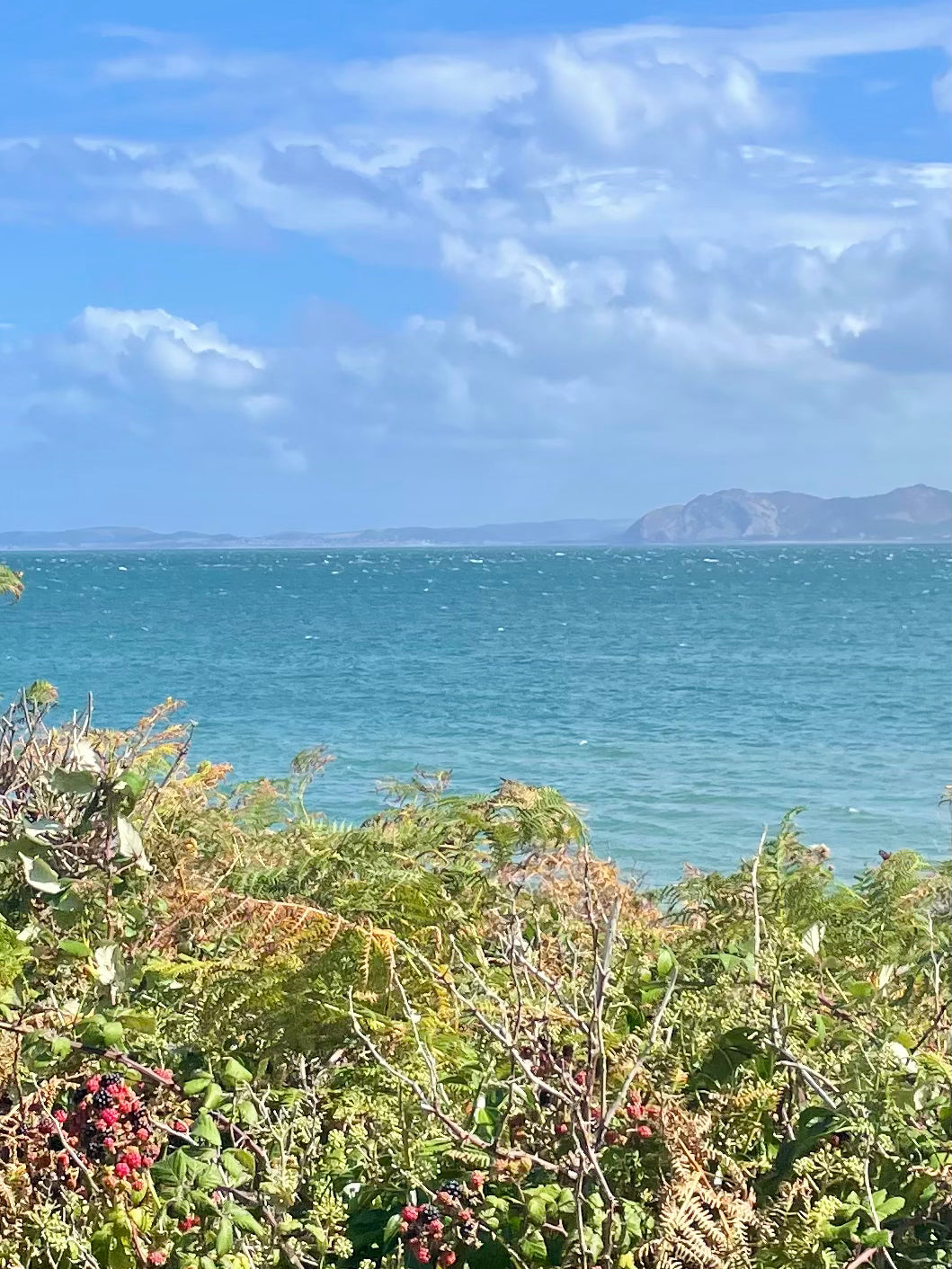
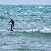
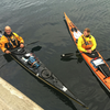
Some downwind options around the North West Wales coastline. The listed routes have been completed numerous times on SUP foil but there's no reason why someone with the appropriate skills and equipment couldn't complete them using a wing, a parawing, a sea kayak or a surfski.

Trefor to Aberdesach

Optimum wind direction SW
Straight line distance 7.3km
A good spot to assess the conditions for this run is from the finish point carpark at Aberdesach. From here you can see all the way back to the Trefor headland and get a good feel for the amount of wind and white water. Another useful planning tool is the weather station at Caernarfon Airfield which is accessible through the Windy app/website, the weather station records actual wind speeds at regular intervals. In general if there has been 15knts of wind from a SW direction for a couple of hours or more it's worth getting your wetsuit ready.
There are a couple of starting options for this run. The longer approach is to get in from the shelter of Trefor harbour and paddle approximately 800m out to the windline. If you're going for this start it's worth making sure you paddle far enough out to get a good line for the run and to clear the choppy conditions that can be found in the lee of the cliffs. Winging or parawinging out to the conditions would cut this approach time considerably.
If the conditions aren't too big it's possible to start from the West shore which allows you to access the better conditions without the long paddle approach. Launching for this start is from a stoney beach with slippery rocks and dumping waves, your feet will thank you if you use some kind of footwear. The chances of hurting yourself or damaging your kit can be high in anything more than small conditions. The dumping waves can be easier to negotiate if you walk left along the beach / towards the mountains. Once you have safely launched it's approximately 250m to paddle before you turn right and start the run.
Regardless of your starting point the line you need to follow points towards the row of low lying white cottages that form the backdrop to the Aberdesach beach. Throughout the run the conditions are likely to remain pretty consistent, though on marginal days you are likely to notice the conditions easing slightly once you are about a kilometre clear of Trefor. If the conditions are small enough to make takeoffs difficult at Trefor you should expect mid run paddle-ups to be more difficult and more tiring. Once on foil you will often find that turning left off the bumps is necessary to keep on the correct track.
If you need to finish early there are exit options available to your right for the entire length of the run. That said it's worth considering that much of the shoreline is difficult to access from the road so if you do decide to finish early you will need to factor in a potential long walk to get to a public footpath or the road.
The beach at Aberdesach is generally pretty rocky. As you approach the beach there is a submerged but shallow rocky section of water that sticks out from the shore. It's worth giving this a wide berth especially around low water.
Aim to finish on the left (looking from the sea to the land), of the blue storm pipe that sticks out from the car park. Another useful reference is aiming to finish in front of the cottages to the left of the car park, (looking from the sea to the land). At low water you'll find an easy sandy exit but at high water you'll need to exit across some stoney ground.
The shuttle for this route is simple with a car or van. There is free parking at Aberdesach and at the beach in Trefor. If you are going for the West shore start there is limited parking along the track before the bus depot at the bottom of the quarry incline. If you are going for a solo run there is a good cycle path which runs along the side of the main road.
Trefor to Dinas


Optimum wind direction SSW
Straight line distance 12km
If the wind is closer to South than West and around 15-20kts in strength you will notice conditions lining up for a run between Trefor and Dinas Dinlle. The weather station at Caernarfon Airfield is a useful tool for checking what the wind has been doing over the previous few days. You can access it through the Windy app/website.
For most of this run you will be approximately a mile offshore travelling parallel to low lying shoreline, most of which could be used to exit early if necessary. The headland and mountains behind Trefor are likely to affect the conditions in the early part of this run but once you are a 1km or so into the run you'll find things will become more consistent. The final 1/4 can become more choppy as you approach the shallower water.
There are a couple of start options. Starting from the West Shore gets you into the conditions quickly but involves launching from a rocky beach with dumping waves. If you don't fancy taking your chances with the west shore start you can paddle out from the harbour in Trefor. This is a longer approach but avoids the rocky shore dump on the west shore.
Dinas Dinlle is easy to identify from Trefor thanks to the two wind turbines on the airfield. As you get closer to the beach at Dinas Dinlle you can decide where to exit the water. In heavy conditions and around high tide you will notice the waves dump onto pebbles and rocks. In these conditions it's worth finishing to the left (looking from the sea towards the land), of a rocky groyne / breakwater mid way along the beach.
With a car or van the shuttle is simple. There are convenient car parks at Dinas Dinlle and Trefor harbour. For the West shore start parking is more limited at the end of the road that leads to the bottom of the quarry incline next to the bus depot. You can also use a bike to complete the shuttle although this will involve you leaving your board hidden and/or securely fastened to something close to your chosen start point.
Penrhynside to Llanddulas


Optimum wind direction WNW
Straight line distance 9.2km
When the conditions come in from a north westerly direction you will get foil-able waves at various places along the North Wales coast. This run is effectively a crossing of Colwyn Bay. The best vantage points to check out the conditions for this run are from the beach car park at Llanddulas or the point in Rhos on Sea.
The start of this run is from the shadow of the Little Orme headland. Access to the stoney beach is pretty straightforward using a public footpath and steps that lead from Penrhyn Beach Road. It's worth taking the time to spot your line and the finish point. With good visability you should be able to see the complete route, the general line is directly across the bay aiming for the low ground after the higher hill sides and quarries.
Conditions in the initial stages usually consist of relatively clean rolling swell with limited breaking waves so an efficient takeoff willmake a lot of difference to your overall pace. Once you're up on foil cutting left at every possibility until you clear Rhos Point will keep you away from the shallower water. After Rhos point the shoreline pulls away to your right and you'll soon find yourself well away from the shallow water and the sandy beaches of Colwyn Bay. From Rhos Point to the exit the conditions should now include more in the way of breaking waves as well as rolling swell and the need to constantly cut left is not so important.

As the run reaches the last couple of kilometers you should keep an eye out for a Raynes Jetty with a windsock on the end, this is your signal to start planning your exit. The section between the jetty and Llanddulas runs parallel with the A55 main road and has been fortified with some pretty hefty storm defences. Trying to finish through the defences would be extremely difficult.
Around high tide the water's edge in front of the Llanddulas carpark is very rocky and the waves can be pretty dumpy. There are rows of groynes which you will also need to avoid. If you don't fancy your chances with this exit option you should continue towards the east going past a small river-mouth to where the exit is more sheltered and less rocky.
Shuttle choices for this run include the obvious A55. The coastal cycle path is another option if you're going solo and using a bike. There is plenty of car parking space at Llanddulas close to the finishing point. The parking at the start is among the housing estate on Penrhyn Beach East road.
Shell Island to Barmouth


Optimum wind direction NW
Straight line distance 11.5km
This is a worthwhile trip when the wind has been blowing from the NW. You can get a good look at conditions before you start from the main road just north of Barmouth. Conditions during the run should be pretty consistent from start to finish. Expect plenty of white caps and troughs, straight-forward takeoffs, opportunities for turning on waves and linking bumps.
To get to the water at the start point involves getting across the Shell Island campsite. At certain times of the year the spring tides will cover the access causeway so it's worth checking in advance that the road will be open when you arrive. There is a handy calendar on the Shell Island Campsite website that tells you when access will be restricted. If you want to park a car or drive onto the site there is a fee. If you pay to drive onto the site you can park a vehicle very close to the start point. If you park at the reception building you will need to walk for about 10 minutes to get to the sandy beach from where you can launch.

The run will basically parallel the shoreline. In the initial stages it is worth cutting out right to get to deeper water and better conditions. Once you feel comfortably away from the shore you can focus on following the conditions all the way to your exit point in Barmouth. The finish line is difficult to see from the start but as long as your keep the land to your left you'll be on the right track. Beyond Barmouth the coastline swings out to the west and into Cardigan Bay, this obvious change to the shoreline works as a useful reference feature and navigational backstop. For the entire length of this run you could exit at any point along the coastline by heading to the left.
The beach in Barmouth is long and sandy, getting off the water is usually simple but the walk to your vehicle can be pretty long if you don't plan ahead and get some useful reference points.
Barmouth is a popular summer holiday destination with funfairs and arcades. As such, there is plenty of paid parking along the promenade just behind the beach where your run will finish.
There is a useful train line that connect Barmouth and Llanbedr combine the train with a short bike ride and this make the solo shuttle pretty painless. If you have the luxury of two vehicles then the obvious main road makes the shuttle very straight forward.
Llanfairfechan to Llandudno (West shore)


Optimum wind direction = SW
Straight line distance from start to finish = 11km
Works best around the high tide. Plan to be on the water around an hour before high tide and off the water by high tide plus one hour.
The run starts from the slipway next to the Llanfairfechan sailing club. Your point of aim is the right hand side of the Great Orme where the ground levels out and becomes the West shore of Llandudno. At times during this run you are likely to be around 2km from land. Options for an early exit are possible by aiming for the beach around Penmaenmawr but this option is likely to involve taking an awkward line across the prevailing conditions.
The bumps tend to build for the first quarter of the run then remain pretty constant until the final quarter where it may become more choppy as you reach the shallower water around the mouth of the Conwy estuary. During the final stages of the run look for the boulder breakwater coming in from the left and try to land on the sand behind the boulders. Exiting further round towards the righthand side of the beach is possible but involves a rocky exit.
Shuttle options include road, bike and train. With two vehicles the shuttle is pretty straight forward. Free parking along the road at West shore and paid parking at Llanfairfechan with no height restrictions.
If you are going solo you'll need to drop your board and paddle close to the sailing club at Llanfairfechan and secure them to something solid using a bike lock. You can then drive to the West shore and park your van/car close to your exit point. Walk, taxi or 20-30 minute bike ride to Llandudno junction train station. Jump on a train back to Llanfairfechan then it's a 5 minute bike ride from the Llanfairfechan train station to the sailing club.
Foil your way back to your vehicle and don't forget to retrieve your bike for your next outing.
Llanfairfechan to Morfa Conwy


Optimum wind direction = WSW
Straight line distance from start to finish = 8.6km
Timing your run an hour either side of high tide is the most reliable plan.
If you can see rolling swell from the carpark in Llanfairfechan it's on!
Start from the slipway next to the sailing club on the promenade in Llanfairfechan. Lots of potential for mid run exits along the Penmaenmawr stoney beach between the two headlands. From the water the final destination can be located by identifying the obvious angle change in the horizon between the rocky hillside and the sandy beach that leads towards the Great Orme / Llandudno. For most of the run you will be approximately 1.5km offshore travelling parallel to the land.
Conditions vary through the length of the run, generally they will be nicely lined up at the beginning and at the end but can become a bit more choppy between the Penmaenmawr and Penmaenbach headlands. As you approach the Penmaenbach (second) headland aim for the yellow channel marker that leads into the shipping lane for the Conwy marina. Further red and green marker buoys will help keep you in the deep water and away from the sand banks where the water is often more choppy. Once you have cleared the Penmaenbach headland the bumps can become more organised and the wind can drop back. From here you will need to cut right towards the beach and the car park.

In terms of shuttle options the A55 dual carriage-way makes driving simple with convenient car parking options at both ends. The free car park at Morfa Conwy has a 1.9m height barrier. There is also limited roadside parking if you are driving a vehicle that won't fit under the barrier. At Llanfairfechan there is plenty of pay and display car parking and no height barrier.
Another shuttle option if you are going solo is to make use of the cycle-path that runs alongside the A55. Drop your board off at Llanfairfechan and secure it to something solid with a bike lock within site of the cctv cameras. Drive yourself to the Morfa Conwy car park and park up. Jump on your bike and cycle along the cycle-path back to Llanfairfechan. Swap your bike for your board then ride the waves back to your vehicle.
Safety notes.
The details in this article are intended to be used for general guidance only and do not constitute any kind of formal advice or official instructions. Over time the details may become outdated or even obsolete. As a paddler heading out on the sea you need to be fully aware of the hazards you are exposing yourself to and must take all reasonable safety precautions to ensure your own safety.
Telephoning the coastguard in Holyhead before and after your trip is a good way to keep them informed about what you're doing. Members of the public often report paddlers to the coastguard if they see someone along way offshore on a windy day. At the time of writing the Coastguard in Holyhead weren't routinely monitoring the RYA Safetrx app so bear this in mind if you are using the platform.
Downwind paddling, by it's nature, involves heading out to sea when the wind is blowing and the waves are rolling. It can be a pretty harsh and unforgiving environment that has the potential to bite hard if you don't plan effectively for all eventualities.
If there's doubt, don't go out!

